July 2010 Archives
For those of you in town for Siggraph, I highly recommend getting over to the Academy's Samuel Goldwyn theater off of Wilshire Blvd and Robertson. Until August 22nd there are two great exhibits that are free to the public! We went this weekend, and both were quite fascinating. Check out scans below!

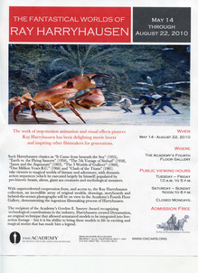
We spent about an hour at both exhibits, and there were very few people mingling about on a Saturday afternoon. I highly recommend it if you have a spare hour! Unfortunately, photography is not allowed, or you'd see some photos of the exhibit here!.
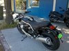
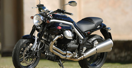
Some of you may remember this post, where I discussed some of the choices I was facing. That was two years ago. I really quite liked the Moto Guzzi, and after test riding one several weeks ago, I placed my order! I picked up this 09 Moto Guzzi Griso 8V last Wednesday for a wicked steal, and have been riding it every day since! It's a wonderfully aggressive beast, with an amazing amount of character. The power on startup is so strong that it torques the entire 500lb bike to the right with a twist of the throttle. It has a beautiful cacophony, distributed among the gearshift, exhaust, and engine. It's not so fast that it will get me in to trouble, but at the same time, has a decent increase in power over my last bike, 1151cc over the 487cc of my Suzuki. For those that are interested in magazine racing, the Griso will do 0-60 in 3.8. Personally, I haven't tested this fact, I've just been getting used to the size of the engine and the handling! While it is loads bigger than my Suzuki, it is easier to handle! That probably stems from the years in which each of the bikes was made, this Griso in 2009, the Suzuki in 1999. I haven't taken too many pictures of my bike just yet, but there is a plethora on the internet. Here's just one.

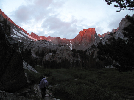
Well readers, a bunch of things have happened in the last couple weeks, and I just haven't had the time to sit down and write about them! A couple of weeks ago you may have read that I was preparing for a Mt. Whitney hike, and two weekends ago, we did it!
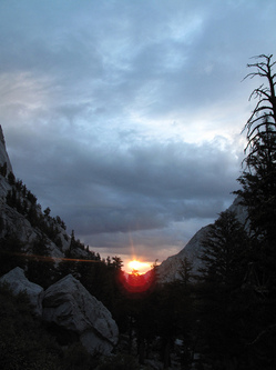
The photo to the left here is the sunrise from about 10,000 feet. It's around 6:00am in the morning. After two downpours (you can see the storm clouds in the foreground), I took this picture as we looked back into the valley. We started the trek at 2:30am, when we woke up and prepared to hit the trail. After a quick breakfast and backpack prep, we started on the Mt. Whitney trail at 3:20am. We hiked for the first 2.5 hours in the dark, just following our headlamps as they bounced around the terrain. At around 5:30am we could faintly see our surroundings, and at 6:00 we could turn off our headlamps and see the trail ahead. Our route started at 8,200 feet, and we had done the first three miles of the hike by 6 am. Good time. The route itself has a quota of 100 people per day that are allowed to day hike the mountain. So here we are, at ten thousand feet, taking a picture of the rising sun breaking through the clouds, and it's drizzling. Luckily, it only gets better as we go further up the mountain. As the clouds clear out, it becomes a very nice day!

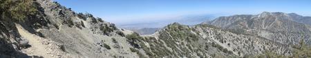
Over the Fourth of July weekend here in the states, many people gorge themselves on all things American, celebrating our independence. For me, I spent it outside on the trail, and on July 5th, no less. If you are wondering, I can't recall what I did on Sunday. But here's a video clip from Monday.
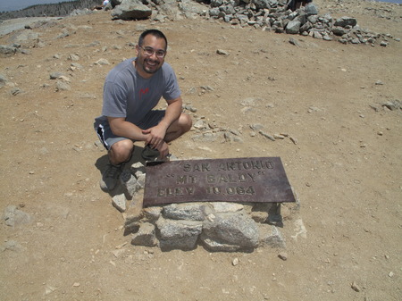
This footage was taken on the way back down from the peak. The peak in question? Mt. Baldy, here in the San Gabriel Mountains, just north of Los Angeles. Here's a panorama of the Devil's Backbone trail, which I took on the descent. Click on it to see the BIG picture.
But what about the ascent you ask? Was I so preoccupied with taking pictures and video of the descent that I forgot the peak? Ooh no.